Clarence River Estuary Coastal Management Program
Clarence River Estuary Coastal Management Program Scoping Study
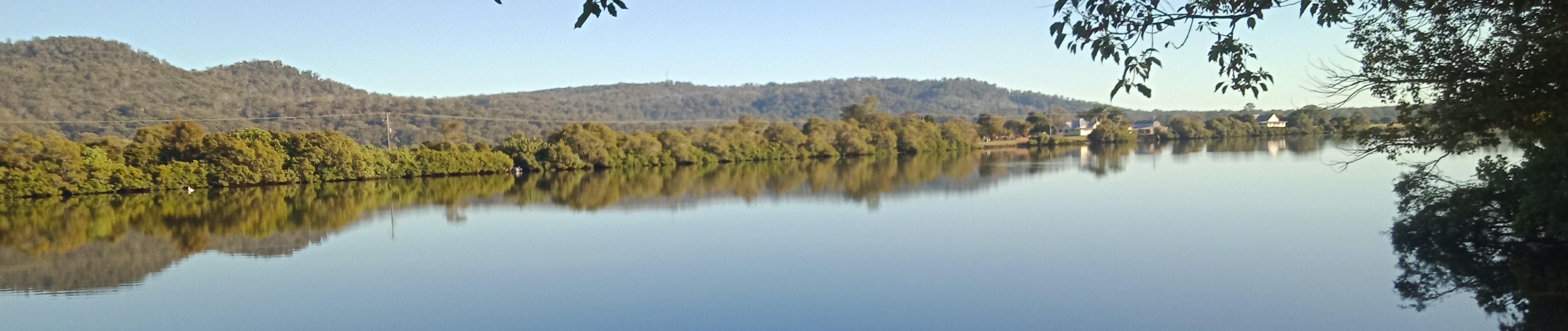
The Clarence River system is one of the largest in Australia. Many parts of the river system are in good condition but a range of past activities, rapid development and changes in land use continue to have an adverse effect on parts of the river system including the estuary. Council is required to prepare Coastal Management Programs (CMPs) in accordance with the Coastal Management Act 2016 and State Environmental Planning Policy (Coastal Management) 2018. The current estuary management plans for the Clarence Valley are now being updated to CMPs.
Clarence River Estuary Coastal Management Program Scoping Study
The Clarence River system is one of the largest in Australia. Many parts of the river system are in good condition but a range of past activities, rapid development and changes in land use continue to have an adverse effect on parts of the river system including the estuary. Council is required to prepare Coastal Management Programs (CMPs) in accordance with the Coastal Management Act 2016 and State Environmental Planning Policy (Coastal Management) 2018. The current estuary management plans for the Clarence Valley are now being updated to CMPs.
As outlined in the NSW Coastal Management Manual, CMP preparation is undertaken in five stages. The final objective of this five-stage process is to develop and apply a long-term strategy with appropriate management actions for the area. In September 2022, Council completed and adopted the CMP Scoping Study (Stage 1). You can download these documents (Volume 1 and 2) from this page (right). Council is progressing Stage 2 during 2026.

The Clarence River has a large catchment area which extends from the Queensland border east of Stanthorpe in the north-west, to Ebor and Dorrigo in the south and east to the entrance at Yamba / Iluka. The catchment has historically undergone substantial land use modifications and as such the management of the entire catchment has a significant impact on the health of the estuary. The study area for the CMP will include the entire Clarence River catchment to capture aspects of the broader catchment that have an impact on estuary health. The Clarence River entrance to Whiting Beach is being considered in a separate CMP for the Clarence Valley coastline and will not be included in the Clarence River estuary CMP.
Stakeholder engagement is an important component of each stage of the CMP development. As part of the Scoping Study, feedback was obtained through a community survey, feedback tools on the Clarence Conversations webpage and other stakeholder input. The feedback received provides a good snapshot of stakeholder opinion about the study area including popular activities, locations of current issues, management priorities and the community’s vision for the future of the estuary. The feedback received is included in Volume 2 of the Scoping Study. At all stages, the community is welcome to post questions and feedback on this page. Thank you to everyone who has provided input so far. There will be additional opportunities to be involved in the CMP development in later stages.
We appreciate your time in helping to manage this remarkable river system.
![]()
Questions
Ask any questions or discuss ideas. We value the many different points of view in our community and only ask that your contribution to the conversation is respectful.
-
Share Can you tell me the correct regulations concerning collection of seaweed from Shark Bay for domestic use ? I believe it is one bucket per person per day from below the tide line. on Facebook Share Can you tell me the correct regulations concerning collection of seaweed from Shark Bay for domestic use ? I believe it is one bucket per person per day from below the tide line. on X (formerly Twitter) Share Can you tell me the correct regulations concerning collection of seaweed from Shark Bay for domestic use ? I believe it is one bucket per person per day from below the tide line. on Linkedin Email Can you tell me the correct regulations concerning collection of seaweed from Shark Bay for domestic use ? I believe it is one bucket per person per day from below the tide line. link
Can you tell me the correct regulations concerning collection of seaweed from Shark Bay for domestic use ? I believe it is one bucket per person per day from below the tide line.
Carol Norgate asked almost 2 years agoHi Carol,
Thank you for your enquiry although the question is not relevant to the project page. However, I can advise that NSW DPI - Fisheries is responsible for the regulation of gathering/collection of marine vegetation in NSW. The National Parks and Wildlife Service (NPWS) is responsible for the management of Bundjalung National Park at Shark Bay. For details or clarification on the regulation of the collection of seaweed at Shark Bay please contact NSW DPI - Fisheries https://www.dpi.nsw.gov.au/contact-us or NPWS https://www.nationalparks.nsw.gov.au/visit-a-park/parks/bundjalung-national-park
-
Share The river bank in the Palmer's Island Village is decaying very bad since the last flood most of the rocks have slid in the river a few yrs ago they did down near the caravan park and stopped at the start of the village one of the old cement wharfs is on a dangerous angle and during the drought the land surrounding it had large cracks next flood it will probably slide in this is a dangerous area younge children play at the park and fish there with no clue to the hazard conditions river banks are meant to have trees growing beside them that's what holds banks together planting some native plants will strengthen the land on Facebook Share The river bank in the Palmer's Island Village is decaying very bad since the last flood most of the rocks have slid in the river a few yrs ago they did down near the caravan park and stopped at the start of the village one of the old cement wharfs is on a dangerous angle and during the drought the land surrounding it had large cracks next flood it will probably slide in this is a dangerous area younge children play at the park and fish there with no clue to the hazard conditions river banks are meant to have trees growing beside them that's what holds banks together planting some native plants will strengthen the land on X (formerly Twitter) Share The river bank in the Palmer's Island Village is decaying very bad since the last flood most of the rocks have slid in the river a few yrs ago they did down near the caravan park and stopped at the start of the village one of the old cement wharfs is on a dangerous angle and during the drought the land surrounding it had large cracks next flood it will probably slide in this is a dangerous area younge children play at the park and fish there with no clue to the hazard conditions river banks are meant to have trees growing beside them that's what holds banks together planting some native plants will strengthen the land on Linkedin Email The river bank in the Palmer's Island Village is decaying very bad since the last flood most of the rocks have slid in the river a few yrs ago they did down near the caravan park and stopped at the start of the village one of the old cement wharfs is on a dangerous angle and during the drought the land surrounding it had large cracks next flood it will probably slide in this is a dangerous area younge children play at the park and fish there with no clue to the hazard conditions river banks are meant to have trees growing beside them that's what holds banks together planting some native plants will strengthen the land link
The river bank in the Palmer's Island Village is decaying very bad since the last flood most of the rocks have slid in the river a few yrs ago they did down near the caravan park and stopped at the start of the village one of the old cement wharfs is on a dangerous angle and during the drought the land surrounding it had large cracks next flood it will probably slide in this is a dangerous area younge children play at the park and fish there with no clue to the hazard conditions river banks are meant to have trees growing beside them that's what holds banks together planting some native plants will strengthen the land
Lee asked over 2 years agoHi Lee, Thanks for your time and information. Bank erosion is a recognised issue at numerous locations right throughout the Clarence River Estuary. Stage 2 of the CMP is proposed to include and estuary wide bank condition assessment which will assess bank erosion and associated impacts/risks across the estuary and prioritise sites for remediation.
-
Share Hi, I wanted to make the planners aware of the significant bank damage, loss of mature mangrove trees and loss of metres of saltmarsh due to bank collapse in the Sandon River arm where boating is permitted. The 8 knots speed limits are routinely ignored by majority of boaters. The boat wash is undercutting banks and leading to damage to the critical habitats. The sandon is unique, with a healthy catchment. But this within river damage is leading to increased turbidity that may be contributing also to the observed loss of seagrass though the river over the past decade as a steady increase in boating, and boat size has occurred in the river. Consideration of the removal of powered craft from this system should be considered to prevent further damage to the essential fisheries habitats. It is clearly caused by boats as the banks in the sanctuary arms of the same system remain in very good condition with mature mangrove trees not fallen over. on Facebook Share Hi, I wanted to make the planners aware of the significant bank damage, loss of mature mangrove trees and loss of metres of saltmarsh due to bank collapse in the Sandon River arm where boating is permitted. The 8 knots speed limits are routinely ignored by majority of boaters. The boat wash is undercutting banks and leading to damage to the critical habitats. The sandon is unique, with a healthy catchment. But this within river damage is leading to increased turbidity that may be contributing also to the observed loss of seagrass though the river over the past decade as a steady increase in boating, and boat size has occurred in the river. Consideration of the removal of powered craft from this system should be considered to prevent further damage to the essential fisheries habitats. It is clearly caused by boats as the banks in the sanctuary arms of the same system remain in very good condition with mature mangrove trees not fallen over. on X (formerly Twitter) Share Hi, I wanted to make the planners aware of the significant bank damage, loss of mature mangrove trees and loss of metres of saltmarsh due to bank collapse in the Sandon River arm where boating is permitted. The 8 knots speed limits are routinely ignored by majority of boaters. The boat wash is undercutting banks and leading to damage to the critical habitats. The sandon is unique, with a healthy catchment. But this within river damage is leading to increased turbidity that may be contributing also to the observed loss of seagrass though the river over the past decade as a steady increase in boating, and boat size has occurred in the river. Consideration of the removal of powered craft from this system should be considered to prevent further damage to the essential fisheries habitats. It is clearly caused by boats as the banks in the sanctuary arms of the same system remain in very good condition with mature mangrove trees not fallen over. on Linkedin Email Hi, I wanted to make the planners aware of the significant bank damage, loss of mature mangrove trees and loss of metres of saltmarsh due to bank collapse in the Sandon River arm where boating is permitted. The 8 knots speed limits are routinely ignored by majority of boaters. The boat wash is undercutting banks and leading to damage to the critical habitats. The sandon is unique, with a healthy catchment. But this within river damage is leading to increased turbidity that may be contributing also to the observed loss of seagrass though the river over the past decade as a steady increase in boating, and boat size has occurred in the river. Consideration of the removal of powered craft from this system should be considered to prevent further damage to the essential fisheries habitats. It is clearly caused by boats as the banks in the sanctuary arms of the same system remain in very good condition with mature mangrove trees not fallen over. link
Hi, I wanted to make the planners aware of the significant bank damage, loss of mature mangrove trees and loss of metres of saltmarsh due to bank collapse in the Sandon River arm where boating is permitted. The 8 knots speed limits are routinely ignored by majority of boaters. The boat wash is undercutting banks and leading to damage to the critical habitats. The sandon is unique, with a healthy catchment. But this within river damage is leading to increased turbidity that may be contributing also to the observed loss of seagrass though the river over the past decade as a steady increase in boating, and boat size has occurred in the river. Consideration of the removal of powered craft from this system should be considered to prevent further damage to the essential fisheries habitats. It is clearly caused by boats as the banks in the sanctuary arms of the same system remain in very good condition with mature mangrove trees not fallen over.
M Landos asked over 3 years agoHi Matt
Thanks for the information you provided. The Sandon River is part of the study area for the Clarence Valley Coastline and Estuaries Coastal Management Program and is part of the Solitary Islands Marine Park. Council is working with DPI – Fisheries, DPI – Marine Parks and the Marine Estate Management Authority in the development of the CMP to identify priority management actions for the Sandon River estuary. DPI representatives are also included on Council’s Coast and Estuary Management Committee which is overseeing the development of the CMP. Damage to estuarine habitats is a key issue to be addressed in the CMP and your feedback will be considered by the CMP project team. You may also wish to contact DPI – Marine Parks directly on 02 6691 0600 or email: solitary.islands@dpi.nsw.gov.au.
-
Share A while back I travelled down the river and just past Harwood I noted trawlers netting in the river. I can understand why, but there were about 5 or 6 operating and this must be detrimental to the river environment as this is a regular occurance. Should we stop all commercial fishing in the river and make it a sanctuary where only recreational fishing is allowed? I believe this would be beneficial to the majority who live in our river community. on Facebook Share A while back I travelled down the river and just past Harwood I noted trawlers netting in the river. I can understand why, but there were about 5 or 6 operating and this must be detrimental to the river environment as this is a regular occurance. Should we stop all commercial fishing in the river and make it a sanctuary where only recreational fishing is allowed? I believe this would be beneficial to the majority who live in our river community. on X (formerly Twitter) Share A while back I travelled down the river and just past Harwood I noted trawlers netting in the river. I can understand why, but there were about 5 or 6 operating and this must be detrimental to the river environment as this is a regular occurance. Should we stop all commercial fishing in the river and make it a sanctuary where only recreational fishing is allowed? I believe this would be beneficial to the majority who live in our river community. on Linkedin Email A while back I travelled down the river and just past Harwood I noted trawlers netting in the river. I can understand why, but there were about 5 or 6 operating and this must be detrimental to the river environment as this is a regular occurance. Should we stop all commercial fishing in the river and make it a sanctuary where only recreational fishing is allowed? I believe this would be beneficial to the majority who live in our river community. link
A while back I travelled down the river and just past Harwood I noted trawlers netting in the river. I can understand why, but there were about 5 or 6 operating and this must be detrimental to the river environment as this is a regular occurance. Should we stop all commercial fishing in the river and make it a sanctuary where only recreational fishing is allowed? I believe this would be beneficial to the majority who live in our river community.
rmontey asked over 4 years agoThank you for your input. We note your concerns and will include them in the CMP Scoping Study. Future CMP actions relating to commercial and recreational fishing access will be the responsibility of DPI Fisheries who are participating in the CMP development process.
-
Share An EIS is currently being prepared for an industrial solar project at lower Southgate. The "No Solar For Southgate" group has identified alarming effects this development will have on our waterways and beautiful environment. In previous answers you refer this project as a SDD and appears to be beyond the control of CVC. But I would hope that CVC in conjunction with NSW Dept of Planning, Industry and Environment work towards implementing policies and regulations that prevent this type of industrial development happening in our Valley in areas that are totally inappropriate and unsuitable. We need to protect our waterways and the pristine environment in our valley. on Facebook Share An EIS is currently being prepared for an industrial solar project at lower Southgate. The "No Solar For Southgate" group has identified alarming effects this development will have on our waterways and beautiful environment. In previous answers you refer this project as a SDD and appears to be beyond the control of CVC. But I would hope that CVC in conjunction with NSW Dept of Planning, Industry and Environment work towards implementing policies and regulations that prevent this type of industrial development happening in our Valley in areas that are totally inappropriate and unsuitable. We need to protect our waterways and the pristine environment in our valley. on X (formerly Twitter) Share An EIS is currently being prepared for an industrial solar project at lower Southgate. The "No Solar For Southgate" group has identified alarming effects this development will have on our waterways and beautiful environment. In previous answers you refer this project as a SDD and appears to be beyond the control of CVC. But I would hope that CVC in conjunction with NSW Dept of Planning, Industry and Environment work towards implementing policies and regulations that prevent this type of industrial development happening in our Valley in areas that are totally inappropriate and unsuitable. We need to protect our waterways and the pristine environment in our valley. on Linkedin Email An EIS is currently being prepared for an industrial solar project at lower Southgate. The "No Solar For Southgate" group has identified alarming effects this development will have on our waterways and beautiful environment. In previous answers you refer this project as a SDD and appears to be beyond the control of CVC. But I would hope that CVC in conjunction with NSW Dept of Planning, Industry and Environment work towards implementing policies and regulations that prevent this type of industrial development happening in our Valley in areas that are totally inappropriate and unsuitable. We need to protect our waterways and the pristine environment in our valley. link
An EIS is currently being prepared for an industrial solar project at lower Southgate. The "No Solar For Southgate" group has identified alarming effects this development will have on our waterways and beautiful environment. In previous answers you refer this project as a SDD and appears to be beyond the control of CVC. But I would hope that CVC in conjunction with NSW Dept of Planning, Industry and Environment work towards implementing policies and regulations that prevent this type of industrial development happening in our Valley in areas that are totally inappropriate and unsuitable. We need to protect our waterways and the pristine environment in our valley.
Maria Felton asked over 4 years agoHi Maria,
Thank you for your feedback. We appreciate your concern regarding the proposed industrial scale solar energy generating facility at Boormans Lane, Lower Southgate and Dilkoon Road, Dilkoon and the potential impacts to the surrounding environment from the development.
We are unable to provide comment at this early stage of the proposal. The studies and assessments undertaken as part of the Environment Impact Study (EIS) will provide further detail on any likely impacts at each stage of the proposed development. This will include appropriate measures to avoid impacts on the surrounding environment.
The Planning Secretary’s Environmental Assessment Requirements (SEARs) also requires the EIS to include detailed assessments on the suitability of the land for the proposed development and impacts to existing land uses on the site and adjacent land, including a land use conflict risk assessment.
Other key issues to be addressed by the EIS are biodiversity, heritage, visual amenity, noise, transport, water, economic, waste, social impacts and potential hazards.
We will be undertaking detailed consultation with affected landowners surrounding the development. During this consultation, we will discuss likely and potential impacts of the development to ensure they are considered as part of the EIS assessments.
-
Share That’s a lovely photo of the park. It was taken cattle grazed the area. On a tour of the park last week I found it over grown with weeds ( cobblers peg, wire grass, scotch thistles, mile a minute vine) at times they were higher than the car. Clearly the NSWNP’s have lost the battle with the weeds. Very few birds were observed. There were no brolgas and Jabiru or black swans because their habitat has been over grown and they forage or takeoff. The trees that have been planted 50% have died and half of the remainder are unhealthy. I have observed the park for 30 years (pre & post NSWNPS) and I have given it a health rating of 4/10. on Facebook Share That’s a lovely photo of the park. It was taken cattle grazed the area. On a tour of the park last week I found it over grown with weeds ( cobblers peg, wire grass, scotch thistles, mile a minute vine) at times they were higher than the car. Clearly the NSWNP’s have lost the battle with the weeds. Very few birds were observed. There were no brolgas and Jabiru or black swans because their habitat has been over grown and they forage or takeoff. The trees that have been planted 50% have died and half of the remainder are unhealthy. I have observed the park for 30 years (pre & post NSWNPS) and I have given it a health rating of 4/10. on X (formerly Twitter) Share That’s a lovely photo of the park. It was taken cattle grazed the area. On a tour of the park last week I found it over grown with weeds ( cobblers peg, wire grass, scotch thistles, mile a minute vine) at times they were higher than the car. Clearly the NSWNP’s have lost the battle with the weeds. Very few birds were observed. There were no brolgas and Jabiru or black swans because their habitat has been over grown and they forage or takeoff. The trees that have been planted 50% have died and half of the remainder are unhealthy. I have observed the park for 30 years (pre & post NSWNPS) and I have given it a health rating of 4/10. on Linkedin Email That’s a lovely photo of the park. It was taken cattle grazed the area. On a tour of the park last week I found it over grown with weeds ( cobblers peg, wire grass, scotch thistles, mile a minute vine) at times they were higher than the car. Clearly the NSWNP’s have lost the battle with the weeds. Very few birds were observed. There were no brolgas and Jabiru or black swans because their habitat has been over grown and they forage or takeoff. The trees that have been planted 50% have died and half of the remainder are unhealthy. I have observed the park for 30 years (pre & post NSWNPS) and I have given it a health rating of 4/10. link
That’s a lovely photo of the park. It was taken cattle grazed the area. On a tour of the park last week I found it over grown with weeds ( cobblers peg, wire grass, scotch thistles, mile a minute vine) at times they were higher than the car. Clearly the NSWNP’s have lost the battle with the weeds. Very few birds were observed. There were no brolgas and Jabiru or black swans because their habitat has been over grown and they forage or takeoff. The trees that have been planted 50% have died and half of the remainder are unhealthy. I have observed the park for 30 years (pre & post NSWNPS) and I have given it a health rating of 4/10.
John Hoy asked over 4 years agoThank you for your input to the CMP project. There have been significant additions to the original Everlasting Swamp State Conservation Area in recent years. A project is underway to review the management of water regimes to improve values including ecological, cultural, water quality etc. A restoration plan is being prepared by NPWS to further guide this work, and a reserve Plan of Management is also in preparation. While the Park is the responsibility of NPWS, the CMP will consider broad issues of weeds, biodiversity and floodplain management.
-
Share Good morning. Will the wetlands adjacent Orion Drive/Yamba Road, Yamba, be included in this work? This area is rapidly being overrun by invasive vines which are killing the natural growth (such as the casuarinas). There are also example of prickly pear in this locale. In addition there is one (small) example of a native orchid - the only one for miles - growing on a tree near the footpath and its future is in jeopardy due to encroaching vines. on Facebook Share Good morning. Will the wetlands adjacent Orion Drive/Yamba Road, Yamba, be included in this work? This area is rapidly being overrun by invasive vines which are killing the natural growth (such as the casuarinas). There are also example of prickly pear in this locale. In addition there is one (small) example of a native orchid - the only one for miles - growing on a tree near the footpath and its future is in jeopardy due to encroaching vines. on X (formerly Twitter) Share Good morning. Will the wetlands adjacent Orion Drive/Yamba Road, Yamba, be included in this work? This area is rapidly being overrun by invasive vines which are killing the natural growth (such as the casuarinas). There are also example of prickly pear in this locale. In addition there is one (small) example of a native orchid - the only one for miles - growing on a tree near the footpath and its future is in jeopardy due to encroaching vines. on Linkedin Email Good morning. Will the wetlands adjacent Orion Drive/Yamba Road, Yamba, be included in this work? This area is rapidly being overrun by invasive vines which are killing the natural growth (such as the casuarinas). There are also example of prickly pear in this locale. In addition there is one (small) example of a native orchid - the only one for miles - growing on a tree near the footpath and its future is in jeopardy due to encroaching vines. link
Good morning. Will the wetlands adjacent Orion Drive/Yamba Road, Yamba, be included in this work? This area is rapidly being overrun by invasive vines which are killing the natural growth (such as the casuarinas). There are also example of prickly pear in this locale. In addition there is one (small) example of a native orchid - the only one for miles - growing on a tree near the footpath and its future is in jeopardy due to encroaching vines.
BruceK asked over 4 years agoThank you for your input into the CMP project. The wetlands adjacent to Orion Drive/Yamba Road are located within the project study area. Weeds are acknowledged as an issue, not only within the vicinity of the estuary but across the entire catchment. Weeds are one of the most significant and costly environmental threats in Australia. The North Coast Regional Strategic Weed Management Plan 2017-2022 outlines the primary objectives and strategies for managing priority weeds for the NSW North Coast and the responsibilities of the various stakeholders. CVC is the local control authority responsible for administering the Biosecurity Act 2015 for weeds in the local government area. CVC’s approach to weed management is linked to the legislation which follows a regional risk-based approach contained in the NSW Weeds Action Program (funded by the NSW Government) and aims to control new problem weeds before they become a bigger problem in the region.
-
Share Are you aware that a very beautiful and significant wetland area located next to the mighty Clarence River is under a cloud because at the headwaters of the magnificent Everlasting Swamp there is currently a proposal to place an industrial scale solar power plant, which can and most likely will impinge on the catchment area? A possible example its feed water can be contaminated and assorted wildlife, water life, bird life this being the most vulnerable due to a number of reasons one of which would be the Lake effect from the solar panels themselves on its unique bird life. There are so many issues with this kind of power plant and its placement is just sad completely at odds to the natural surrounding area. It’s parallel to the Clarence so run off to the East will go straight into the river. The waters from the swamp / wetlands on the Western side of the Solar Plant then also eventually flow to the Clarence so if there was to be a contamination mishap it will damage and pollute both the swamp and our Clarence River. on Facebook Share Are you aware that a very beautiful and significant wetland area located next to the mighty Clarence River is under a cloud because at the headwaters of the magnificent Everlasting Swamp there is currently a proposal to place an industrial scale solar power plant, which can and most likely will impinge on the catchment area? A possible example its feed water can be contaminated and assorted wildlife, water life, bird life this being the most vulnerable due to a number of reasons one of which would be the Lake effect from the solar panels themselves on its unique bird life. There are so many issues with this kind of power plant and its placement is just sad completely at odds to the natural surrounding area. It’s parallel to the Clarence so run off to the East will go straight into the river. The waters from the swamp / wetlands on the Western side of the Solar Plant then also eventually flow to the Clarence so if there was to be a contamination mishap it will damage and pollute both the swamp and our Clarence River. on X (formerly Twitter) Share Are you aware that a very beautiful and significant wetland area located next to the mighty Clarence River is under a cloud because at the headwaters of the magnificent Everlasting Swamp there is currently a proposal to place an industrial scale solar power plant, which can and most likely will impinge on the catchment area? A possible example its feed water can be contaminated and assorted wildlife, water life, bird life this being the most vulnerable due to a number of reasons one of which would be the Lake effect from the solar panels themselves on its unique bird life. There are so many issues with this kind of power plant and its placement is just sad completely at odds to the natural surrounding area. It’s parallel to the Clarence so run off to the East will go straight into the river. The waters from the swamp / wetlands on the Western side of the Solar Plant then also eventually flow to the Clarence so if there was to be a contamination mishap it will damage and pollute both the swamp and our Clarence River. on Linkedin Email Are you aware that a very beautiful and significant wetland area located next to the mighty Clarence River is under a cloud because at the headwaters of the magnificent Everlasting Swamp there is currently a proposal to place an industrial scale solar power plant, which can and most likely will impinge on the catchment area? A possible example its feed water can be contaminated and assorted wildlife, water life, bird life this being the most vulnerable due to a number of reasons one of which would be the Lake effect from the solar panels themselves on its unique bird life. There are so many issues with this kind of power plant and its placement is just sad completely at odds to the natural surrounding area. It’s parallel to the Clarence so run off to the East will go straight into the river. The waters from the swamp / wetlands on the Western side of the Solar Plant then also eventually flow to the Clarence so if there was to be a contamination mishap it will damage and pollute both the swamp and our Clarence River. link
Are you aware that a very beautiful and significant wetland area located next to the mighty Clarence River is under a cloud because at the headwaters of the magnificent Everlasting Swamp there is currently a proposal to place an industrial scale solar power plant, which can and most likely will impinge on the catchment area? A possible example its feed water can be contaminated and assorted wildlife, water life, bird life this being the most vulnerable due to a number of reasons one of which would be the Lake effect from the solar panels themselves on its unique bird life. There are so many issues with this kind of power plant and its placement is just sad completely at odds to the natural surrounding area. It’s parallel to the Clarence so run off to the East will go straight into the river. The waters from the swamp / wetlands on the Western side of the Solar Plant then also eventually flow to the Clarence so if there was to be a contamination mishap it will damage and pollute both the swamp and our Clarence River.
1Leselle asked over 4 years agoThank you for your input into the CMP project. The Clarence River Estuary CMP will consider broad themes and issues including the potential impacts of land use changes, including urban and industrial development, on the estuary.
The Clarence Valley Solar Farm Project is State Significant Development (SSD) under Part 4 of the Environmental Planning and Assessment Act 1979 with the Department of Planning and Environment (DPE) the determining agency (not CVC) under the delegation of the Minister for Planning and Public Spaces. The proponent of the development is required to prepare an Environmental Impact Statement (EIS) and Development Application (DA) for submission to the DPE for determination. The EIS will document how the proposal impacts a range of matters including biodiversity, heritage, land, visual amenity, noise, transport, water (including an assessment of the likely impacts of the development on surface water and groundwater resources and measures proposed to monitor, reduce and mitigate these impacts), hazards, social, economic and waste. Proponents of SSD are typically required to consult with the community, local Council and other key government agencies throughout the project planning process.
-
Share There are current development plans to build an industrial sized solar farm(Clarence Valley Solar Farm) at 58 Boormans Lane, Lower Southgate. This development is proposed to cover 300 acres and positioned between on a ridge between the Clarence River to the east and Warragai and Bluey Creek to the west. These 2 creeks feed the Everlasting Swamp National which is a critical wet land and estuary system. The solar panels contain a number of heavy metals. Given the frequency of major hail storms in this specific area this development poses a serious environmental risk. I trust this issue can be considered within the current study. on Facebook Share There are current development plans to build an industrial sized solar farm(Clarence Valley Solar Farm) at 58 Boormans Lane, Lower Southgate. This development is proposed to cover 300 acres and positioned between on a ridge between the Clarence River to the east and Warragai and Bluey Creek to the west. These 2 creeks feed the Everlasting Swamp National which is a critical wet land and estuary system. The solar panels contain a number of heavy metals. Given the frequency of major hail storms in this specific area this development poses a serious environmental risk. I trust this issue can be considered within the current study. on X (formerly Twitter) Share There are current development plans to build an industrial sized solar farm(Clarence Valley Solar Farm) at 58 Boormans Lane, Lower Southgate. This development is proposed to cover 300 acres and positioned between on a ridge between the Clarence River to the east and Warragai and Bluey Creek to the west. These 2 creeks feed the Everlasting Swamp National which is a critical wet land and estuary system. The solar panels contain a number of heavy metals. Given the frequency of major hail storms in this specific area this development poses a serious environmental risk. I trust this issue can be considered within the current study. on Linkedin Email There are current development plans to build an industrial sized solar farm(Clarence Valley Solar Farm) at 58 Boormans Lane, Lower Southgate. This development is proposed to cover 300 acres and positioned between on a ridge between the Clarence River to the east and Warragai and Bluey Creek to the west. These 2 creeks feed the Everlasting Swamp National which is a critical wet land and estuary system. The solar panels contain a number of heavy metals. Given the frequency of major hail storms in this specific area this development poses a serious environmental risk. I trust this issue can be considered within the current study. link
There are current development plans to build an industrial sized solar farm(Clarence Valley Solar Farm) at 58 Boormans Lane, Lower Southgate. This development is proposed to cover 300 acres and positioned between on a ridge between the Clarence River to the east and Warragai and Bluey Creek to the west. These 2 creeks feed the Everlasting Swamp National which is a critical wet land and estuary system. The solar panels contain a number of heavy metals. Given the frequency of major hail storms in this specific area this development poses a serious environmental risk. I trust this issue can be considered within the current study.
Andrew Wilson asked over 4 years agoThank you for your input into the CMP project. The Clarence River Estuary CMP will consider broad themes and issues including the potential impacts of land use changes, including urban and industrial development, on the estuary.
The Clarence Valley Solar Farm Project is State Significant Development (SSD) under Part 4 of the Environmental Planning and Assessment Act 1979 with the Department of Planning and Environment (DPE) the determining agency (not CVC) under the delegation of the Minister for Planning and Public Spaces. The proponent of the development is required to prepare an Environmental Impact Statement (EIS) and Development Application (DA) for submission to the DPE for determination. The EIS will document how the proposal impacts a range of matters including biodiversity, heritage, land, visual amenity, noise, transport, water (including an assessment of the likely impacts of the development on surface water and groundwater resources and measures proposed to monitor, reduce and mitigate these impacts), hazards, social, economic and waste. Proponents of SSD are typically required to consult with the community, local Council and other key government agencies throughout the project planning process.
-
Share Hi, will seagrass mapping of Lake Wooloweyah be completed prior to this CMP being published. All seagrass has been lost since the Lake Wooloweyah CZMP was published in 2009. Mapping of seagrass was an outstanding action from this management plan. Failure to acknowledge total seagrass loss will impact the ability of the CMP to adequately manage issues in the lake. on Facebook Share Hi, will seagrass mapping of Lake Wooloweyah be completed prior to this CMP being published. All seagrass has been lost since the Lake Wooloweyah CZMP was published in 2009. Mapping of seagrass was an outstanding action from this management plan. Failure to acknowledge total seagrass loss will impact the ability of the CMP to adequately manage issues in the lake. on X (formerly Twitter) Share Hi, will seagrass mapping of Lake Wooloweyah be completed prior to this CMP being published. All seagrass has been lost since the Lake Wooloweyah CZMP was published in 2009. Mapping of seagrass was an outstanding action from this management plan. Failure to acknowledge total seagrass loss will impact the ability of the CMP to adequately manage issues in the lake. on Linkedin Email Hi, will seagrass mapping of Lake Wooloweyah be completed prior to this CMP being published. All seagrass has been lost since the Lake Wooloweyah CZMP was published in 2009. Mapping of seagrass was an outstanding action from this management plan. Failure to acknowledge total seagrass loss will impact the ability of the CMP to adequately manage issues in the lake. link
Hi, will seagrass mapping of Lake Wooloweyah be completed prior to this CMP being published. All seagrass has been lost since the Lake Wooloweyah CZMP was published in 2009. Mapping of seagrass was an outstanding action from this management plan. Failure to acknowledge total seagrass loss will impact the ability of the CMP to adequately manage issues in the lake.
Nick obrien asked over 4 years agoThanks for your question Nick,
The first stage (of five stages) is to complete a scoping study, which looks and existing information, information gaps and undertakes stakeholder engagement.
At this early stage I cannot advise what additional information or studies will be undertaken during the development of the CMP or recommended as an action in the CMP.
The whole process of CMP development will take at least two years.
Who's Listening
-
UM
Documents

Lifecycle
-
Stage 1 - Scoping Study
Clarence River Estuary Coastal Management Program has finished this stageThe scoping study involves collation of existing information, community and stakeholder engagement and scoping of technical studies to fill key information gaps.
-
Stage 2 - Detailed studies of vulnerabilities and opportunities
Clarence River Estuary Coastal Management Program is currently at this stage -
Stage 3 - Identification and evaluation of options
this is an upcoming stage for Clarence River Estuary Coastal Management Program -
Stage 4 - Prepare, exhibit, certify and adopt the CMP
this is an upcoming stage for Clarence River Estuary Coastal Management Program -
Stage 5 - Implementation, monitoring and reporting
this is an upcoming stage for Clarence River Estuary Coastal Management Program
Thank you for your contribution!
Help us reach out to more people in the community
Share this with family and friends